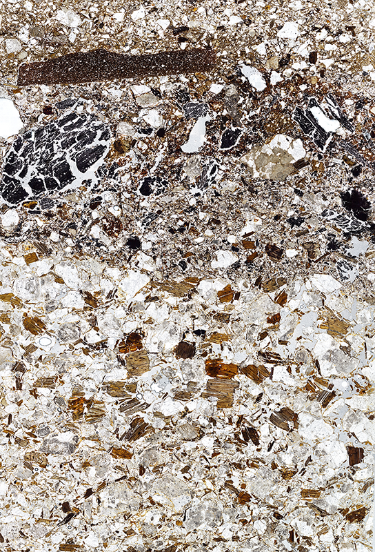
Every year, hundreds of archaeological sites of diverse chronology are excavated throughout the world. All of them have a common denominator: they are stratigraphic archives reflecting human behaviour in the past. Archaeologists apply different scientific protocols to excavate and understand the underlying logic in the genesis of the strata that make up the chronostratigraphic sequence. However, few of them apply methods and analysis techniques designed to understand the formation of the many different sedimentary layers. In this sense, Geoarchaeology, understood as the application of Earth Sciences, helps us to understand the anthropogenic and natural processes that caused the formation of the deposits. Among the techniques of this discipline, micromorphology, the petrographic study of archaeological soils and sediments, stands out because it provides a high-resolution microstratigraphic analysis. The general objective of GeoDig project is to develop a digital methodology of contextualized management and visualization of geoarchaeological data integrated in its archaeological context of origin. This project has an integrating and open philosophy of participation in research, involving a wide international network of specialists.
The realization of the GeoDig platform has been possible thanks to the economic and institutional support of the University of Granada and the Visiting Scholars program of the Vice-Rectorate for Research and Knowledge Transfer.